Geodesy Online, professional solution for geospatial data engineers, has announced a new online service for coordinate transformations and coordinate system parameters calibration Geodesy Transform.
Geodesy Transform is a geodetic program that runs in a browser. This is really a website you can open on your phone, computer, tablet, or on any other device with a browser and the Internet.
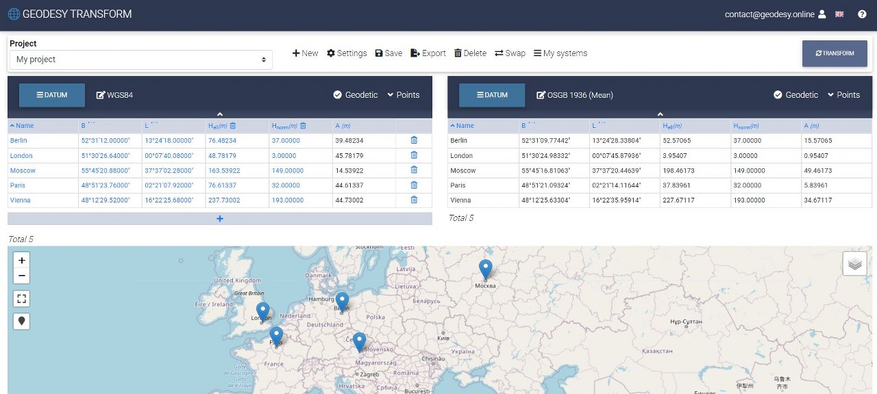
The new online service allows you to recalculate points between coordinate systems, set transformation parameters, create your own coordinate systems. It supports geocentric, spherical, planar coordinate systems, various types of projections, geoid models. Provides SRTM elevation data, recalculates normal heights to geodetic and vice versa.
Let's take a look at the Geodesy Transform feature set in more detail.
- Convert points between different coordinate systems
- Geocentric, spherical, planar coordinate systems support
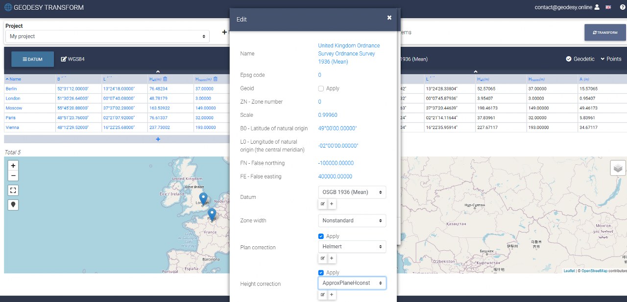
- Transverse Mercator and Lambert Conformal Conic support
Recalculating points is a classic task in geodesy. Geodesy Transform supports popular coordinate system types and successfully copes with the conversion task.
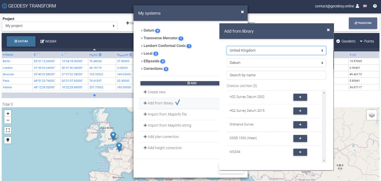
- Access to a comprehensive database of popular coordinate systems
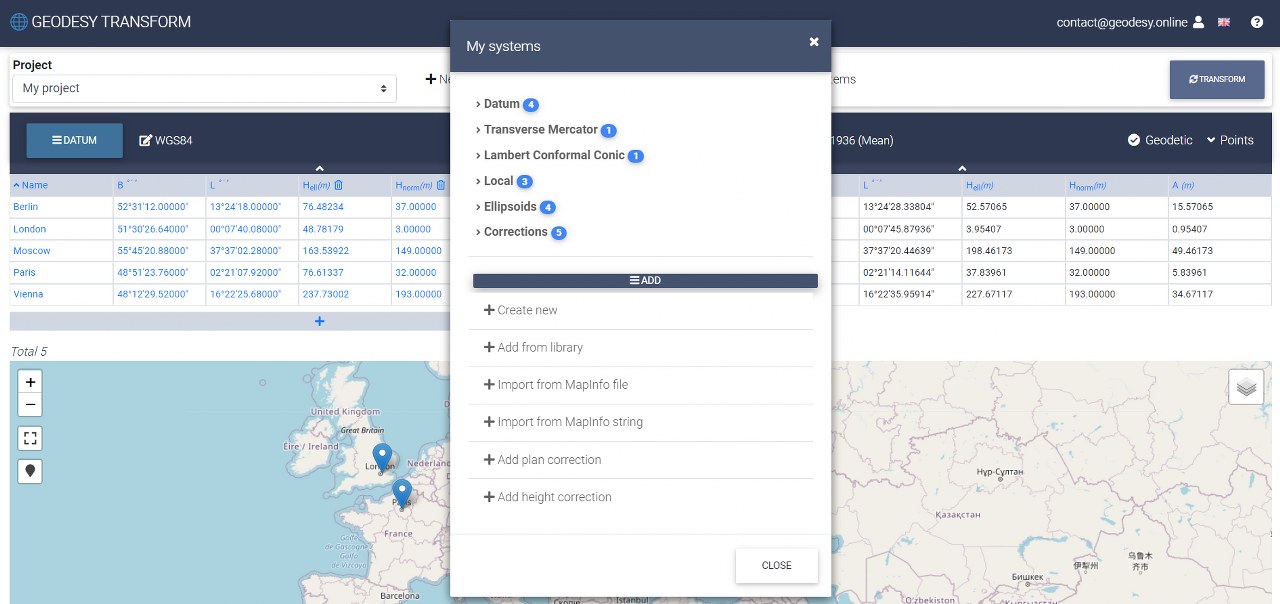
- Creating your own coordinate systems
- Duplicate and modify existing coordinate systems
- Manually define coordinate system parameters
Geodesy Transform provides a big set of predefined coordinate systems (currently there are about 3000 systems grouped by country). A distinctive feature is the ability to create your own coordinate systems. Copying an existing coordinate system will be useful and save your time.
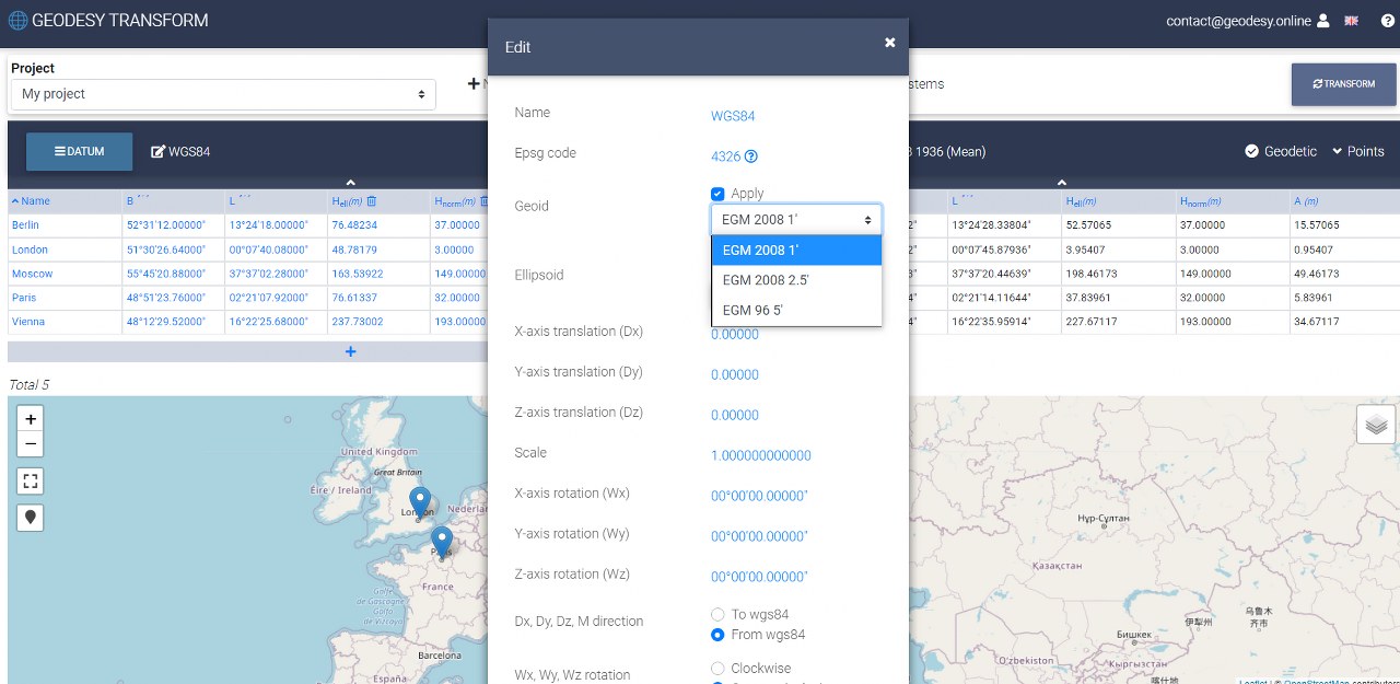
- Support for geoid models EGM 96, EGM 2008
- Geoid anomalies calculation
- Normal (orthometric) heights calculation to geodetic and vice versa
The popular geoid model EGM 96 and EGM 2008 are available in the app. EGM 96 is available with a step rate of 5 ', EGM 2008 with a step rate of 2.5' and 1 '. Geodesy Transform allows you to set different geoid models for different coordinate systems separately and perform calculations between them.
- Works with various units of measurement
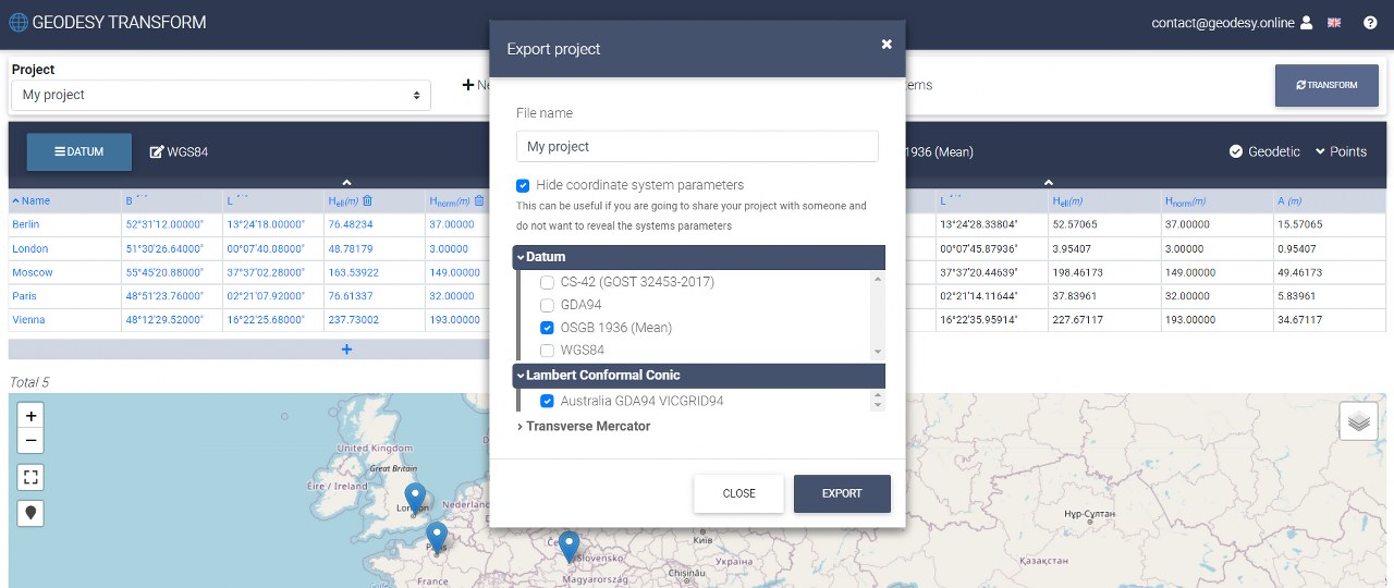
- Import and export projects
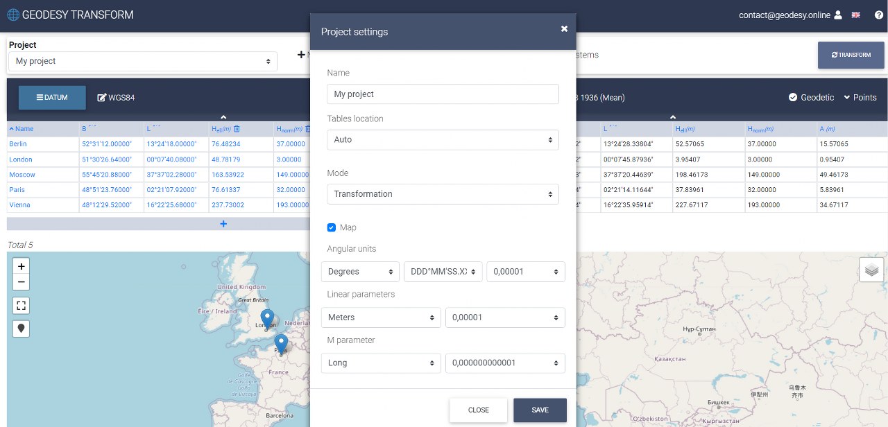
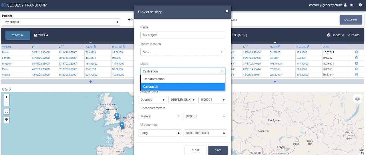
The Geodesy Transform concept assumes work within a separate project. First, you need to create at least one project. The project settings offer a wide range of linear and angular units (degrees, radians, gons, mils, meters, feet). The application supports two modes (transformation, calibration). Also there are some settings related to the display of the map and tables.
- Hidden parameters
An interesting feature is the ability to hide the coordinate systems parameters. They can be hidden from viewing when importing a project. This feature might be useful if you want to share the project with another user, but do not want to disclose the systems parameters.
- Plan and height corrections
Geodesy Transform supports plan and height corrections and includes transformations such as affine, helmert, shift axes, approximating plane, height const.
- Calibration geocentric, geodetic and planar coordinate systems
Calibration is a key feature of Geodesy Transform. The Geodesy Online team has provided a simple and convenient solution for a technically challenging task. The calibration mode will allow you to identify parameters using the least squares method.
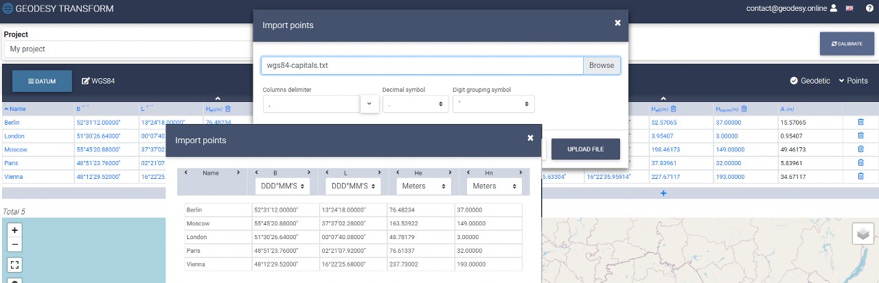
- Points import / export
- Enter coordinates manually when needed
Points can be entered either manually or by importing from a file. The import/export functions are highly configurable. The user can customize parameters such as decimal point, digit group separator, column delimiter, units and some others. This makes it easy to adapt to almost any text file format when importing points.
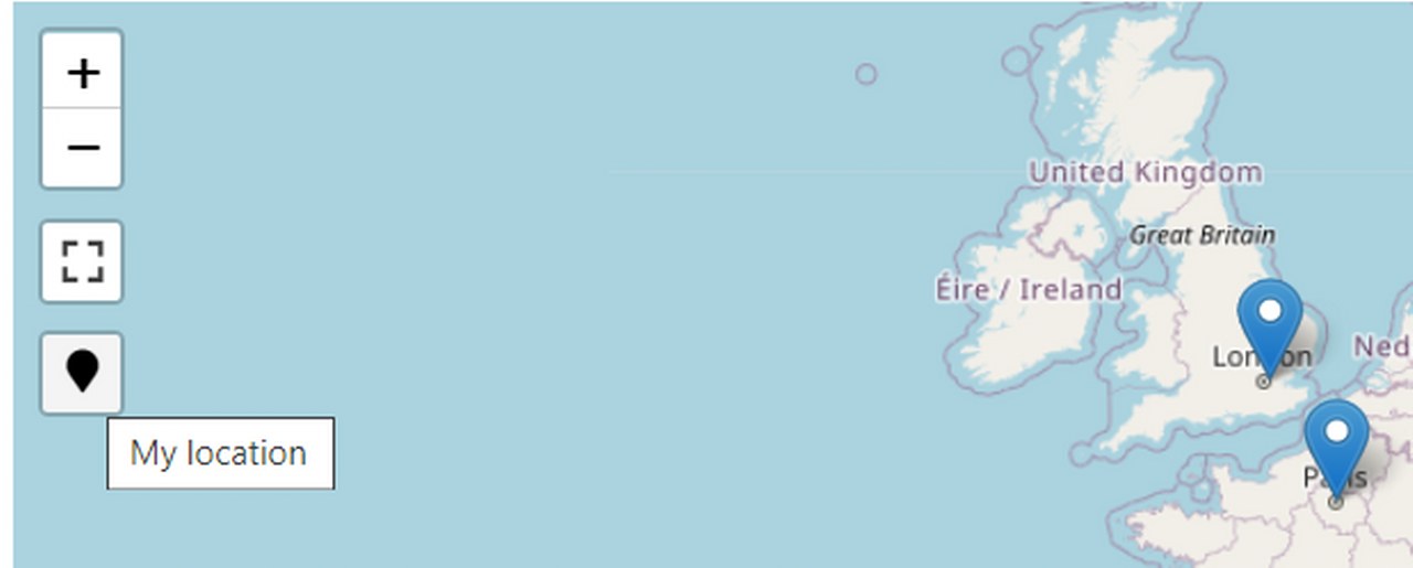
- Displaying points on the map (OpenStreetMap)
- Create points interactively by clicking on the map
For user convenience, entered points are displayed on the map. Users can add the points by clicking on the map.
- Display local coordinate system points using scatter plots
Geodesy Transform provides a scatter plot to display points for local systems with unknown parameters.

- Determining and converting the coordinates of your location to any of the supported coordinate systems
In case your device has an inbuilt GPS module, e.g. smartphone or tablet, you can add points using your location and recalculate them to any of the supported coordinate systems.
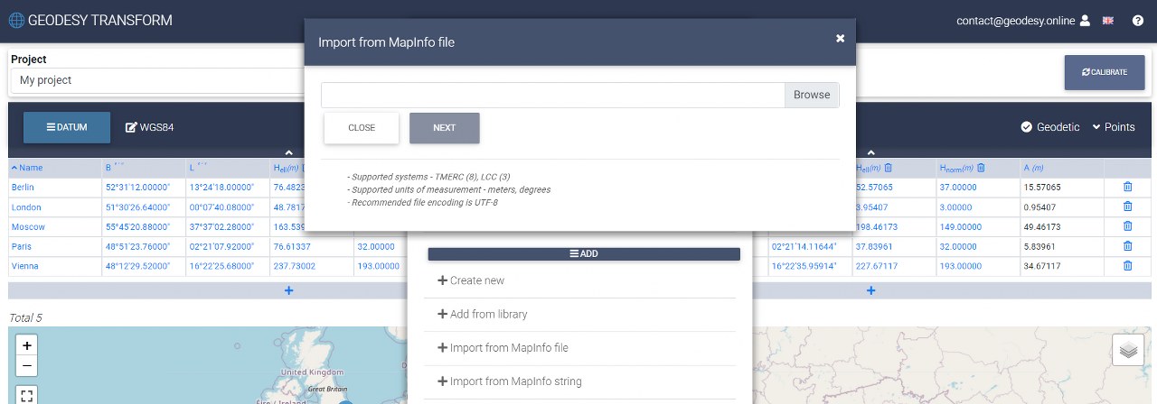
- Import of coordinate systems from Mapinfo format (TMERC, LCC)
Are the coordinate system parameters you need saved in the mapinfo.prj file? Upload the file and add systems. Geodesy Transform allows you to import individual lines from a mapinfo file.
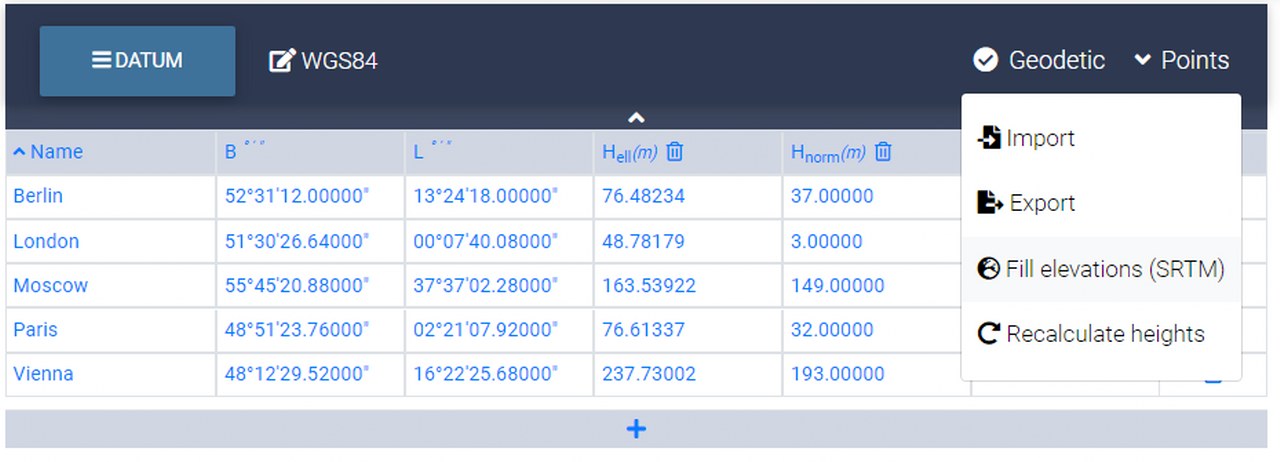
- SRTM elevation data
Geodesy Transform provides SRTM (Shuttle Radar Topography Mission) elevation data. When entering coordinates, the application can calculate the normal height (Hnorm), ellipsoidal height (Hell) and geoid anomaly (A). The last two parameters are calculated if the geoid is specified.
- Let us know what other functions you need?
Send feedback or contact us by email. Geodesy Online team will get back to you as soon as possible and try to answer any questions about working with the service.
The site is developed by enthusiasts for everyone who loves geodesy like our team. Register and start working with us!